![]()
Archived Home|PJIM|Archived PIIM PAPERS™|Archived PIIM RESEARCH™|Contact Us
|
Archived Home|PJIM|Archived PIIM PAPERS™|Archived PIIM RESEARCH™|Contact Us |
|
Home > Development > Emergency Operations Center
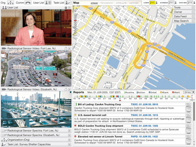
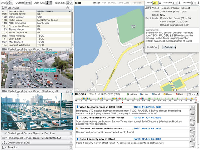
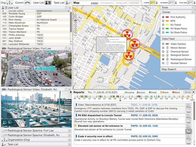
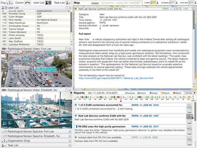
Emergency Operations CenterThe Emergency Operations Center Shared Situational Awareness system provides advanced collaboration and monitoring of the New York and New Jersey region airports, ports, and roadways. This unique system integrates a vast network of satellite offices, sensors, and alert and reporting systems for use by analysts, emergency responders, and decision makers.Needing to meet a rapidly approaching deadline with more than just spreadsheets of technical requirements, The Port Authority of New York and New Jersey (PANYNJ) turned to PIIM to design a thin-client solution to protect the region's airports, ports, and roadways. As a replacement solution to a legacy system, PIIM was additionally tasked to ensure a "3 minute" user adoption requirement. By integrating PIIM's Visualization Driven Rapid Prototyping process with extensive end-user focus groups, usability sessions, and technical reviews, PIIM provided a solution in weeks — not months — to PANYNJ. Delivering one of its unique, all-inclusive visualization and engineering manuals PIIM supplied PANYNJ a meticulous blueprint for each functionality and feature in the system with highly refined representations of each asset, screen state, and user-experience flow. Once delivered, the development task was transferred to the U.S. Army's Communications-Electronics Research, Development, and Engineering Center (CERDEC). Astoundingly, the cerdec engineers were able to complete and deliver the entire Emergency Operations Center Shared Situational Awareness tool without any additional instructions or specifications from PIIM. The PIIM manual created tremendous cost- and time-savings for PANYNJ. The deployed system, which is in use today, offers the following, unique features:
|
|

